
Recording the Fastest Known Time on the Baja Divide
The Baja Divide is a free route resource that is open to ride at anytime. For those that wish to challenge the limits of human potential, a “fastest known time” or FKT will be recognized on the route. Specific guidelines for attempting an FKT are provided below.
Current FKT on the Baja Divide: Miron Golfman 10:13:24
The Baja Divide is not a race.
There will never be a mass start race on the Baja Divide and individual time trials (ITT) that do not challenge the FKT are not formally encouraged. Individual efforts to establish an FKT will be recognized and must be verified with a SPOT tracking device and recorded by Trackleaders.com. Contact bajadivide@gmail.com for inquiries about an FKT attempt on the Baja Divide.
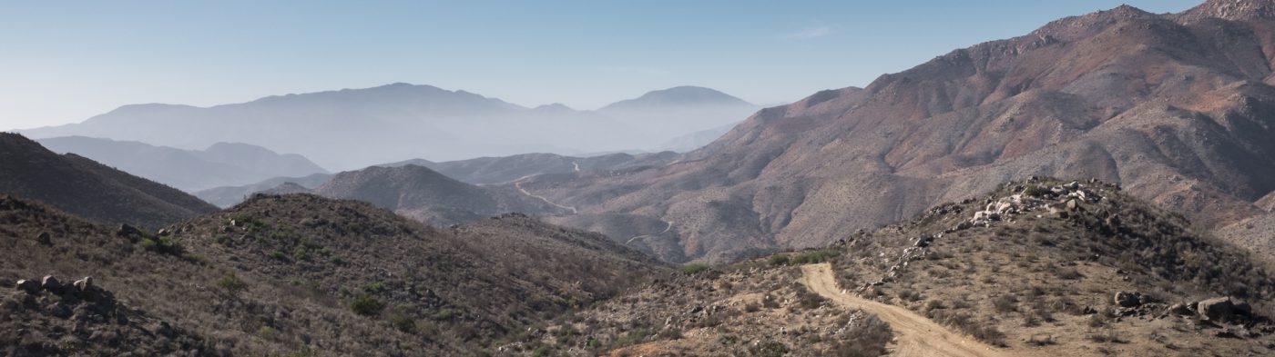
At any speed, the Baja Divide is a challenging route and a powerful experience. We strongly encourage riders to tour at a pace that pleases them, but we generally recommend about 6 weeks to complete the entire route.
Rules:
The rules for recording the fastest known time on the Baja Divide are simple. The course begins in the plaza in Tecate and follows an adapted Baja Divide GPX track, ending just over 1500 miles later in the plaza in San José del Cabo. The ride must be self-supported and the clock is continuous. Riders may only use commercially available resources along the route including bike shops, markets, motels, restaurants, and other businesses. Riders may not pre-arrange support such as water caches or food drops. If a rider needs to leave the route, they may ride or hitch off-route in any direction, but must return to that exact point to continue riding. FKT attempts must be recorded with a SPOT tracker and registered through Trackleaders.com to verify the ride.
Required and permitted alternates from the official Baja Divide:
Tecate: An FKT attempt begins in the public plaza in Tecate, although the official touring route begins in San Diego.
Bahía San Quintín alternate: The salt marsh adjacent to Bahía San Quentin- specifically the mostly-dry river delta east of Lázaro Cárdenas, is susceptible to impassable mud when wet, which occurs during extreme high tides. Riders attempting an FKT are permitted any alternate around this area, but must follow the track out of Lázaro Cárdenas to the west and must pass the point of the route nearest Molina Viejo. If a detour is required, riders will return to MEX1 at Ejido Papalote and will continue on mostly paved roads to rejoin the route near Cielito Lindo, which begins the 4 mile section of beach riding toward Nueva Odisea. This detour is about 8 miles long.
Bahía Concepción alternate: The boat ride across Bahía de Concepción is a very special element of the Baja Divide. However, the boat ride is not possible in some weather. Riders are permitted to ride MEX1 from Mulegé to El Rosarito, bypassing the boat ride across the bay and the ride on the other side.
Santa Anita to San José del Cabo: The official Baja Divide route completes a loop in the cape, which returns the rider to La Paz. For the purposes of an FKT attempt, the route will finish at Plaza Mijares in the historic district of San José del Cabo. Once the rider reaches MEX1 in Santa Anita, just north of San José del Cabo, they will ride south on the main road through the city to the plaza. This is the Baja Divide equivalent to finishing the Tour de France on the Champs-Élysées, although much busier and with more dust and tacos.
Contact bajadivide@gmail.com if you intend to set the fastest known time on the Baja Divide.
